
-
The Department of Public Works and Highways is planning for smooth execution of the Bataan-Cavite Interlink Bridge project
-
A recent inter-agency meeting placed emphasis on minimizing disruptions to maritime traffic through effective traffic management
-
Safeguards have been integrated into detailed engineering design, covering social, environmental, and land-related concerns
-
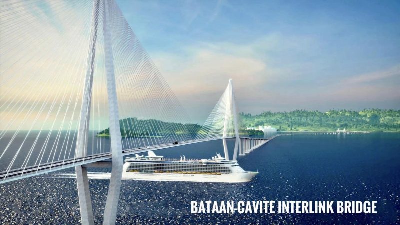
The project, a 32.15-kilometer four-lane initiative, aims to cut travel time between Bataan and Cavite from 5 hours to 45 minutes, reducing congestion in Metro Manila and Luzon gateways
The Department of Public Works and Highways (DPWH) is seeking to minimize disruptions to maritime traffic during construction of the Bataan-Cavite Interlink Bridge (BCIB) project.
DPWH organized a meeting on November 22 with maritime agencies and other stakeholders focusing on maritime navigation and traffic management to mitigate the impacts and risks associated with the upcoming major construction across Manila Bay.
The interagency coordination meeting organized by DPWH Unified Project Management Office (UPMO), included the project’s detailed engineering design consultant – the joint venture of TY Lin International Inc. and Pyungwha Engineering & Consulting Co., Ltd. Representatives from the Philippine Navy, Philippine Coast Guard, Maritime Industry Authority, Philippine Ports Authority, Department of Finance, Bureau of Customs, Authority of Freeport Area of Bataan, Corregidor Foundation, Inc., and local government units of Cavite and Bataan were also present.
DPWH said it intends to establish viable ways to successfully implement the BCIB project with minimal disturbance to maritime affairs during construction.
DPWH UPMO-Roads Management Cluster 2 (Multilateral) Project director Sharif Madsmo Hasim said the meeting addressed securing permits, government duties and taxes, navigational studies, vessel routing, maritime traffic management, and related concerns for about 100 marine vessels.
During public scoping and community interactions, safeguards related to social, environmental, land acquisition, resettlement, gender, land use, and others were included in the detailed engineering design. These measures will be fully implemented during construction.
The BCIB project, spanning 32.15 kilometers with four lanes, represents a major flagship initiative with a 30.87% economic internal rate of return. It aims to significantly reduce travel time between Bataan and Cavite from five hours to 45 minutes, alleviating traffic congestion in Metro Manila, South Luzon, and North Luzon gateways.
READ: Marcos launches Bataan-Cavite bridge project
The bridge alignment in Bataan extends between the Roman Highway, traversing the barren land area at Barangay Alas-Asin, and skirting the shoreline of Barangay Mountain View in Mariveles. In Cavite, the alignment begins from the shoreline of Barangay Timalan Balsahan in Naic, passing through agricultural and residential areas before terminating at Antero Soriano Highway, located in a relatively flat terrain in Barangay Timalan Balsahan and Barangay Timalan Concepcion.


